Pick the tests you want and get one report with your biggest gap before day one. Free, a few minutes, no signup.
Why the Michinoku Coastal Trail wears fit people down
The Michinoku Coastal Trail is a 1,025 km through-route along the Sanriku coast; Walk Japan's self-guided programme walks 96 km of it in 8 days, inn to inn, with vehicle and rail hops between the walked pieces and your luggage sent ahead. Paved lanes, gravel and forest trails, rated gentle to hilly. That is the trap. People read "coastal", "inns" and "self-guided", train for a holiday walk, and arrive at eight consecutive days on uneven cliff-top paths that drop to every cove and come back out on stairs, with 3,046 m of ascent in total.
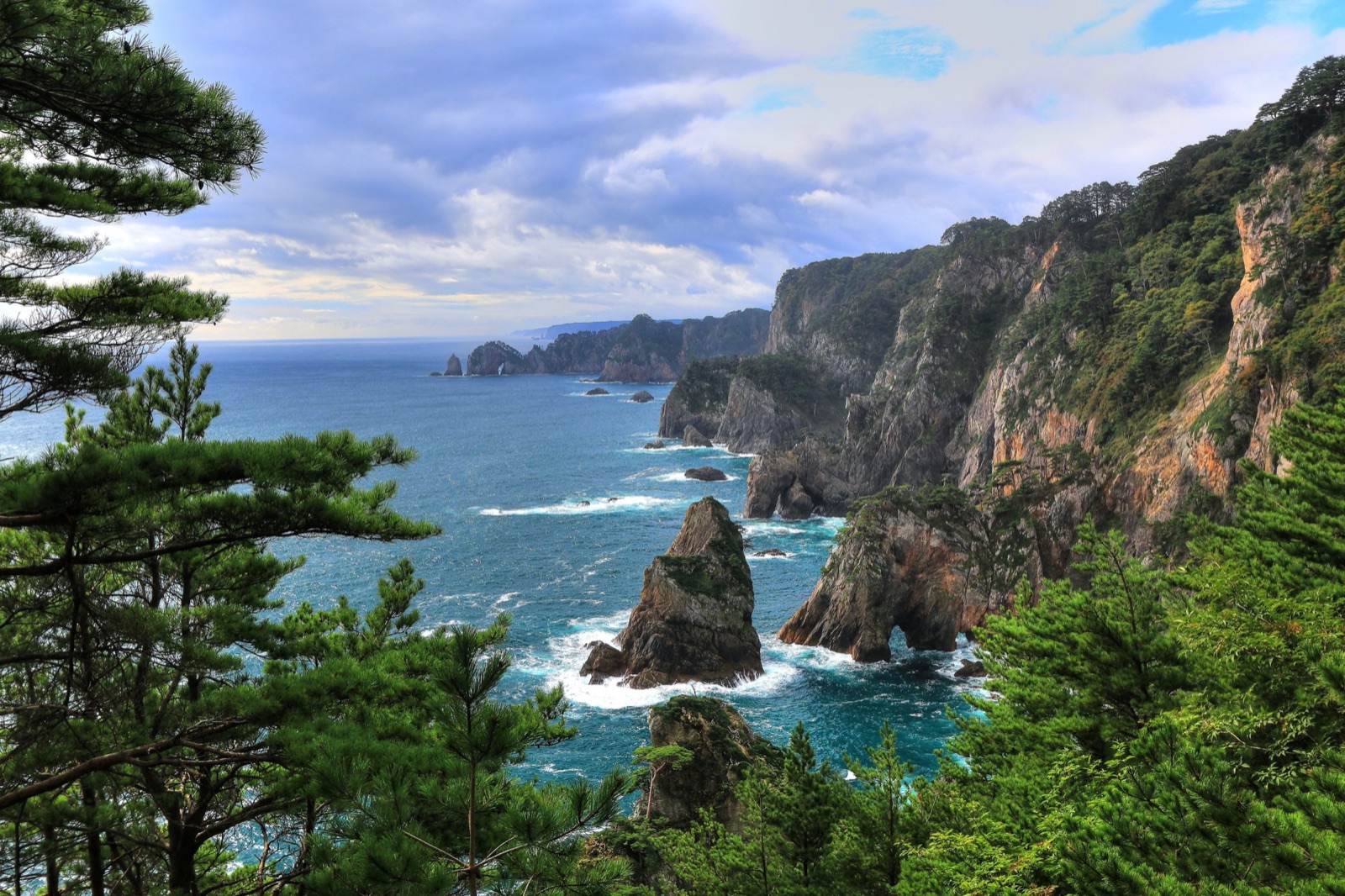
Three things do the damage. The first is the stairs: steep wooden and earth stairways down to coves and back up, short ladders, hand-cut tunnels, so the vertical costs more than the same metres on a graded path, and three days (days 3, 5 and 7) gain over 500 m this way. The second is the accumulation: 8 walking days in a row with no rest day, a typical day of 11.4 km, and the longest, day 7 over the Ryori Pass, 14.3 km and 5 to 6 hours, arriving on legs that have done six. The third is the ground itself: the path runs on unfenced cliff edges with steep drops beside it at Kurosaki, Kitayamazaki and between Hideshima and Jodogahama, the steps are slippery when wet, and the route follows the 2011 tsunami inundation zone with blue evacuation signs to high ground. Tired legs and poor footing are a bad pair on that ground.
The stage profile: Walk Japan's self-guided 8 walking days from Hachinohe to Kesennuma, day by day
Training for a trek starts with its shape. The table is Walk Japan's self-guided Michinoku Coastal Wayfarer, sold as 10 days and 9 nights: arrival in Hachinohe, 8 walking days, departure from Kesennuma after breakfast. The trail itself is a through-route; the programme walks sections of it with pre-booked vehicle and rail hops between them, so the table counts only the walked parts, as the operator's itinerary note says. What the plan is built from, and what you can check your own version against (the guided tour walks seven days with a different split and different inns).
| Day | Stage | km | Gain m | Loss m | Hours | Sleep at |
|---|---|---|---|---|---|---|
| 1 | Kabushima Shrine, Hachinohe (9 m) to Tanesashi Coast (small inn just inland) | 9.4 | +64 | -53 | 2.5 to 4.5 | 27 m |
| 2 | Takonoki trailhead above Tagonoki port, Samurai-hama, Kuji (reserved vehicle from Tanesashi); Samurai-ishi rock 0.7 km in to Itsukushima Shrine on the cape facing Ushijima, Mugyo (then reserved vehicle to Noda) | 11.4 | +385 | -340 | 3.5 to 4.5 | 86 m |
| 3 | Eboshi-so, Noda (on foot from the hotel) to Kurosaki (Kokumin-shukusha Kurosaki-so by the Rikuchu Kurosaki lighthouse) | 16.2 | +573 | -429 | 4.5 to 6 | 150 m |
| 4 | Kurosaki (Kurosaki-so) to Kitayamazaki Visitor Center (then vehicle to Tanohata) | 10.1 | +280 | -274 | 3.5 to 4.5 | 19 m |
| 5 | Shinsai Memorial Park Nakanohama, Miyako (train Tanohata to Ichinowatari, then taxi) to Jodogahama, Miyako (beach, visitor center and the hotel 600 m on) | 12.2 | +567 | -508 | 4 to 6 | 46 m |
| 6 | Toni station, Kamaishi (Sanriku Railway from Miyako) to Yoshihama station via the Kuwadai Pass (437 m), then train to Ofunato | 11.4 | +458 | -439 | 3.5 to 4.5 | 29 m |
| 7 | Ryori (east trail start), Ofunato to Rikuzen-Akasaki station via the Ryori Pass (484 m), then train and bus back to the Ofunato inn | 14.3 | +512 | -477 | 5 to 6 | 29 m |
| 8 | Anatoshi-iso rocks, Goishi coast (reserved vehicle from Ofunato) to Goishi-Kaigan-guchi BRT stop (31 m) | 11.5 | +207 | -225 | 3.5 to 5 | 28 m |
About 96 km, 3,046 m of ascent and 2,745 m of descent over eight days. Eight nights in inns and hotels (a minshuku, kokumin-shukusha lodges, onsen hotels), the highest at Kurosaki-so above the cliffs, 150 m. No porters needed: main luggage goes ahead by courier every day and you carry a daypack; on the Jodogahama night the luggage travels on to Ofunato, so the daypack holds a change of clothes for one evening. Vehicle and rail hops between the walked pieces are not counted. Daily figures differ by operator and by camp choice; the table follows the canonical trek database (two independent itineraries plus a terrain measurement of the route, checked 2026-10-18).
Read the table as a training brief. Day 1 is a warm-up along the Tanesashi coast, 9.4 km and almost flat. Days 2 to 5 are the cliff days: 16.2 km and 573 m of ascent on day 3 from Noda to Kurosaki, the biggest ascent of the week, and 567 m up and 508 m down on day 5 to Jodogahama, the biggest descent. Days 6 and 7 are the two old Hama-kaido mountain roads over the Kuwadai Pass (437 m) and the Ryori Pass (484 m), day 7 the longest at 14.3 km and 5 to 6 hours. Day 8 is the Goishi coast, 11.5 km, then the bus to Kesennuma. The consecutive days, the stairs and the footing are what the plan is built around. Altitude is not: the highest point of the week is 484 m and the highest night 150 m.
What a trek asks that a summit does not
A single summit has one big day. The Michinoku Coastal Trail has eight medium ones, none of them high, all of them on uneven ground and stairs, with the longest at the end of the week. That is a different physiology, and a plan built for a single peak day misses it.
- Consecutive days, not one day. 8 walking days, no rest day, 4.1 hours and 11.4 km on a typical day. Fatigue accumulates faster than fitness recovers, so the plan trains back-to-back long days, not a single rehearsal.
- Stairs, not slope. Most of the week's 3,046 m of ascent is stairways down to coves and back up, on wooden and earth steps that are slippery when wet. Stair sessions with a daypack, down as well as up, are the most specific training there is.
- Descent is spread across the week. 2,745 m of descent, 508 m of it on day 5, on steps. Eccentric leg strength is not an add-on; it is what keeps the knees happy on day 7.
- A daypack, nothing more. Luggage travels by courier between the inns every day, so you carry water, lunch and rain gear. Train with that daypack, loaded as you will carry it; the demand is hours on your feet, not weight on your back.
- Footing, weather and awareness, not altitude. Unfenced cliff edges with steep drops beside the path in places, wet steps, the rainy season from mid to late June, bears active from spring to autumn, and a route through the 2011 tsunami zone with evacuation signs to follow after any strong shaking. Fitness buys attention: a walker who is not exhausted watches the ground and the signs.
Physical benchmarks to hit before the Michinoku Coastal Trail
The Michinoku Coastal Trail loads five physiological systems. A real preparation plan trains all five, with the consecutive days and the stairs at the centre.
Altitude: what the itinerary handles and what training cannot
Altitude is the one thing the Michinoku Coastal Trail does not ask of you at all. The high point is 484 m (1,588 ft) at the Ryori Pass on day 7, the other pass, the Kuwadai, is 437 m, the cliff days never go above 197 m, and the highest night is 150 m at Kurosaki-so above the cliffs. Nobody acclimatises for it and no acclimatisation days are scheduled.
What replaces altitude as the limiter is footing, weather and attention. The path has unfenced cliff edges and steep drops beside it at Kurosaki, Kitayamazaki and between Hideshima and Jodogahama, short ladders, stairs and hand-cut tunnels, and wet steps are slippery. The programme runs in spring and autumn (April to June and September to November); the Tohoku rainy season usually starts in mid to late June. Asian black bears are active from spring to autumn, so carry a bell and avoid dawn and dusk, and the route follows the 2011 tsunami inundation zone, so follow the blue evacuation signs to high ground after any strong shaking. Trail status changes (a stairway at Horinai station is closed with a road detour; the Ryori Pass was closed for most of a year after a forest fire and has reopened), so check the trail association's notices before you go. The fitter you are, the more of your attention is left for the ground. Our hiking training guide covers the base, and the hiking versus mountaineering guide explains why a trek like this is trained differently from a peak.
The 12 to 16 week Michinoku Coastal Trail preparation timeline
The block runs backwards from your departure date. Six phases, each with a distinct target. The hardest training weeks land three to six weeks before you fly, not in the final taper.
- Weeks 1 to 4 · Aerobic base. Three to four Z2 sessions a week, 45 to 90 minutes. Walk, hike, run, cycle; weight on feet preferred. One stair session from week 3.
- Weeks 5 to 8 · Base plus strength plus the weekend pair. Add one eccentric leg session a week and make the weekend two consecutive Z2 walks on uneven ground, daypack on.
- Weeks 9 to 11 · Muscular endurance. Weekend days grow to 4 to 5 hours and 12 to 16 km with 400 to 600 m of gain (a typical day is 422 m, the biggest 573 m), on uneven ground and steps where you can find them, the Sunday walk stays long.
- Weeks 12 to 13 · Long-day rehearsal. One 5 to 6 hour day of about 14.3 km with about 500 m of gain on uneven ground, the daypack and the real food: the shape of day 7.
- Week 14 · Last big weekend. One more back-to-back pair at full length, then the taper begins.
- Weeks 15 to 16 · Taper. Volume drops 30 to 50 percent, one short sharp session stays, legs arrive fresh in Hachinohe.
A weekly distribution that works
The polarised principle applies: most of the week at low intensity, one hard session, and the weekend pair that makes a trek plan different from a summit plan, two long days back to back (Seiler & Kjerland, 2006). A representative week, 10 weeks out from Michinoku Coastal Trail:
- Mon · easy 60 min Z2 walk or run
- Tue · threshold intervals, 4 x 4 min Z4, or hill repeats
- Wed · rest or 30 min mobility
- Thu · 60 to 90 min stairs, Z2, daypack on, 300 to 500 m of gain, down as well as up
- Fri · eccentric strength: weighted step-downs, split squats, calf and hip work, 40 min
- Sat · long Z2 walk, 4 to 5 hours, 12 to 16 km, 400 to 600 m of gain on uneven ground, daypack
- Sun · second long walk on tired legs, 2.5 to 3.5 hours, with steps in it, daypack on (the back-to-back day)
Roughly 80% of weekly volume sits at Z1 to Z2, with one hard intensity session and the back-to-back weekend. Vertical and hours accumulate progressively across the block. The deeper rationale is in our heart rate zones guide; the descent work is explained in eccentric descent training.
How TTM trains the plan to the Michinoku Coastal Trail
Five things the plan is built around
- Fitness target · The Michinoku Coastal Trail is set to a fitness target the model associates with walking the eight days with margin. Your plan is engineered to reach that level by your departure date, and the readiness number tells you how far off you are, with the basis stated.
- Stage-shaped long days · The weekend long days are sized from the itinerary above, not from a generic hiking template: hours and distance grow toward the 11.4 km typical day, then toward the 14.3 km of day 7.
- Back-to-back loading · The plan schedules consecutive long days in the build and specific phases because that is the demand. Multi-day durability is scored as its own component of your readiness.
- Descent eccentric load · Eccentric strength and downhill stair repeats are programmed from the middle of the plan to prepare for 2,745 m of stepped descent in eight days, not bolted on at the end.
- Weekly recalibration · Every Sunday the plan re-reads your watch data (Garmin, Suunto, Coros, Polar, Apple Health) and adjusts the next week: missed sessions, a cold, a bigger-than-planned weekend, all accounted for.
When you tell TTM your trek is the Michinoku Coastal Trail and your departure date, the plan is built backwards from that date with the stage profile above engineered in, and it recalculates every week, every Sunday, against your actual training data from your watch. You do not need to assemble the pieces yourself.
Michinoku Coastal Trail: quick answers
How fit do I need to be for the Michinoku Coastal Trail?
Fit enough to walk 2.5 to 6 hours a day for 8 days in a row on uneven coastal paths and stairways, with a daypack, including a 573 m day between Noda and Kurosaki and a 14.3 km day over the Ryori Pass. No technical skill is needed: Walk Japan rates the programme Activity 4 and Technical 4 (paved lanes, gravel and forest trails, gentle to hilly, sometimes uneven or slippery) and recommends poles. The benchmark that matters most is consecutive days: if two long walks on a weekend, with stairs in them, leave you fine on Monday, you are close. If one long walk wrecks you for three days, you have a durability gap, and that is what 12 to 16 weeks of training fixes.
How many weeks does it take to train for the Michinoku Coastal Trail?
Twelve to sixteen weeks from a base of two or three sessions a week. Less if you already walk long days regularly; more if you are starting from little. The hardest training weeks should land three to six weeks before you fly, with a two week taper after them.
What is the hardest day of the Michinoku Coastal Trail?
Day 7, Ryori to Rikuzen-Akasaki over the Ryori Pass at 484 m, is the longest: 14.3 km, 512 m up and 477 m down, 5 to 6 hours, on an old Hama-kaido mountain road. Day 3, Noda to Kurosaki, has the biggest ascent (573 m over 16.2 km of cliff path), and day 5, Nakanohama to Jodogahama, the biggest descent (508 m), much of both on stairs.
Do I need to train on stairs for the Michinoku Coastal Trail?
Yes, more than for most treks. The coast path drops to every cove on steep wooden and earth steps and comes back up the same way, so stair sessions with a daypack, down as well as up, once a week from week 3, plus one eccentric leg-strength session a week for the knees, are the most specific preparation there is.
Is altitude a problem on the Michinoku Coastal Trail?
No. The high point is 484 m and the highest night 150 m. The limiters are the consecutive days, the stairs, the footing on unfenced cliff paths and wet steps, and the weather, not the air.
What do I carry on the Michinoku Coastal Trail?
A daypack with water, lunch and rain gear. Walk Japan sends your main luggage ahead by courier between the inns every day; on the Jodogahama night it goes on to Ofunato, so you carry a change of clothes for one evening. There are no porters and no need for them. Lunches are your own: villages have shops and vending machines, but days 2, 5, 6 and 7 have long forest sections without them, so buy lunch before you start.
When should I walk the Michinoku Coastal Trail?
Walk Japan runs the self-guided programme in spring and autumn, April to June and September to November; the Tohoku rainy season usually starts in mid to late June, and bears are active from spring to autumn. There is no trail permit, park fee or registration: the inns and the vehicle transfers are booked by the operator. Plan the 12 to 16 week block backwards from your start date, and check the trail association's notices for closures before you go.
Common questions about training for the Michinoku Coastal Trail
How fit do I need to be for the Michinoku Coastal Trail?
Fit enough to walk 2.5 to 6 hours a day for 8 consecutive days on uneven coastal paths and stairways with a daypack, including a 573 m day and a 14.3 km day over the Ryori Pass. The benchmark that matters most is two long walks on a weekend, with stairs in them, that leave you fine on Monday.
How many weeks does it take to train for the Michinoku Coastal Trail?
Twelve to sixteen weeks from a base of two or three sessions a week. The hardest training weeks land three to six weeks before you fly, followed by a two week taper.
What is the hardest day?
Day 7, Ryori to Rikuzen-Akasaki over the Ryori Pass at 484 m, is the longest (14.3 km, 5 to 6 hours); day 3 has the biggest ascent (573 m) and day 5 the biggest descent (508 m), much of both on stairs.
Is the Michinoku Coastal Trail the same as the MCT or the Michinoku Shiokaze Trail?
Yes. Michinoku Coastal Trail, MCT and Michinoku Shiokaze Trail (みちのく潮風トレイル) all name the same 1,025 km through-route along the Sanriku coast of Tohoku. This page follows Walk Japan's self-guided Michinoku Coastal Wayfarer, which walks 96 km of it in 8 days between Hachinohe and the Goishi coast at Ofunato, with vehicle and rail hops between the walked sections.
Do I need to train on stairs?
Yes. The path drops to every cove on steep wooden and earth steps and comes back up the same way. Stair sessions with a daypack, down as well as up, once a week from week 3, plus one eccentric leg-strength session a week for the knees.
Is altitude a problem?
No. The high point is 484 m and the highest night 150 m; the limiters are the consecutive days, the stairs, the footing and the weather.
What do I carry?
A daypack with water, lunch and rain gear. Main luggage travels by courier between the inns every day; on the Jodogahama night it goes on to Ofunato, so the daypack holds a change of clothes for one evening. No porters.
Do I need a guide or a permit?
No guide and no permit. The programme is self-guided with a route booklet and phone support from Walk Japan, which books the inns and the pre-booked vehicle transfers; there is no trail permit, park fee or registration.
When is the best time to walk it?
April to June and September to November, the spring and autumn windows in which Walk Japan runs the programme. The Tohoku rainy season usually starts in mid to late June, and bears are active from spring to autumn.
How hard is the Michinoku Coastal Trail?
The Michinoku Coastal Trail is 8 days: 96 km, 3,046 m of ascent and 2,745 m of descent. A typical day is about 4.1 hours with 422 m of ascent; the longest, day 7, is 5 to 6 hours with 512 m up and 477 m down. The high point is 484 m. The camp or your luggage is carried for you, so you walk with a daypack. No scrambling: cliff-top forest trails with many steep stairways down to coves and back up, unfenced cliff edges at Kurosaki, Kitayamazaki and between Hideshima and Jodogahama, short ladders and hand-cut tunnels, and wet steps that are slippery. The route follows the 2011 tsunami zone (follow the blue evacuation signs after any strong shaking), Asian black bears are present (carry a bell, avoid dawn and dusk), and trail closures change, so check the MCT notices before the trip. There is no rope work on the standard route. In training terms the difficulty is consecutive days, the daily vertical, the descents and the pack, and 12 to 16 weeks from a base of two or three sessions a week covers it; the 16-week Michinoku Coastal Trail training plan is the fixed version.
How long is the Michinoku Coastal Trail?
The Michinoku Coastal Trail is 96 km in 8 days, about 30 to 41 hours of walking in all, with 3,046 m of ascent and 2,745 m of descent, from Same station, Hachinohe (9 m) to Goishi-Kaigan-guchi BRT stop, Ofunato (31 m). That is the standard itinerary; operators move camps and merge days, which changes individual days, not the total.
Can I do the Michinoku Coastal Trail without training?
Not well, and for most people not safely. The Michinoku Coastal Trail asks for 8 consecutive days, about 4.1 hours and 422 m of ascent on a typical day and 5 to 6 hours on the longest. Untrained walkers are the ones the later days hurt: fatigue accumulates faster than fitness recovers, the 2,745 m of descent lands on quads that have never braked for hours, and the gap shows on the longest day, not the first. Twelve to sixteen weeks from a base of two or three sessions a week is enough for most people; the 16-week Michinoku Coastal Trail training plan is the fixed version and the app builds the personalised one backwards from your departure date.
Tools and deeper reading
Take this further
- Trek Check · Test if you are ready for the Michinoku Coastal Trail today. Free, a few minutes. Readiness, muscular endurance, Zone 2 and a fuel plan, one report with your biggest gap.
- The Michinoku Coastal Trail training plan · The week-by-week version of this page: a 16-week plan you can follow, and how the personalised version differs.
- Eccentric Descent Training · Why a long descent destroys quads, and the specific eccentric work that prevents the late-day breakdown.
- Strength Training for Hikers · The leg and hip strength that keeps a week of walking injury-free.
- How to Train for Hiking · The aerobic base, the long day and the pack, from the first weekend walk to a multi-day trek.
- Heart Rate Zones · The polarised 80/20 distribution, why Z2 dominates, how to find your zones.
- The Science Behind TTM · Banister's model, polarised distribution, altitude physiology, eccentric load: the research the plan is built on.
Related treks
Training for something similar?
- Laugavegur Trail · Iceland, 4 days, 54 km, high point 1,100 m. 16-week plan.
- Quilotoa Loop · Ecuador, 3 days, 35 km, high point 3,880 m. 16-week plan.
- Torres del Paine W Trek · Chile, 5 days, 79 km, high point 871 m. 16-week plan.
The takeaway
The Michinoku Coastal Trail is rarely a fitness problem in the abstract. It is a shape problem: the people who step off the bus in Kesennuma with legs to spare trained for 8 consecutive days of 2.5 to 6 hours on uneven paths and stairways, with 3,046 m of ascent and 2,745 m of descent in steps, not for a flat coastal stroll. Train the week and the stairs, not the day, and leave your attention for the ground.