
The normal route from La Besurta via the Renclusa hut crosses the crevassed Aneto Glacier to the 3,404 m (11,168 ft) summit and finishes on the Puente de Mahoma, a short exposed ridge (grade PD). It is about 9 hours round trip without stops, so it demands a full alpine day of aerobic endurance, glacier skills and a steady head for exposure.
Why Aneto punishes underprepared climbers
Aneto is the highest mountain in the Pyrenees and in Aragon, at 3,404 m (11,168 ft). The normal route starts at La Besurta (1,900 m / 6,234 ft), passes the Refugio de la Renclusa, crosses the Aneto Glacier, the largest in the Pyrenees, then finishes on the Puente de Mahoma, a short but exposed ridge. Grade PD. It is about 4 hours 40 minutes to the summit and about 9 hours round trip without stops, with about 1,600 m (5,250 ft) of cumulative gain.
Three things decide the day, and none of them is altitude. The first is the glacier. It is crevassed and shrinking, so conditions change from year to year. Moving on it without rope-team competence is not a fitness problem; it is a safety problem. The second is the Puente de Mahoma. The ridge is short and exposed, and you reach it, and later reverse it, on tired legs. The third is the descent. After the summit, you reverse the ridge, re-cross the glacier, and walk back down. Quads that climbed for hours now have to brake for hours.
All three are trainable or learnable.
Pick the tests you want and get one report with your biggest gap before summit day. Free, a few minutes, no signup.
Physical benchmarks to hit before Aneto
Our read: on the numbers below, Aneto asks for endurance for a long day on your feet, sustained climbing with a long descent on tired legs, time at altitude (the summit is at 3,404 m / 11,168 ft), and the skills listed further down this page, which fitness cannot replace.
What published sources on Aneto ask of climbers (guide services, clubs, parks and a few others, each named), and what the route itself demands. Quotes are word for word from each source, and every line links to it.
To see where you stand against these, take Summit Check for Aneto.
Altitude and terrain on Aneto: 3,404 m (11,168 ft)
At 3,404 m (11,168 ft), altitude is not the dominant problem on Aneto for most fit climbers. You may notice the thinner air on the final ridge, but acute mountain sickness is a smaller risk than on higher peaks. The real limiters here are the long summit day, the glacier, and the Puente de Mahoma under fatigue. Sleeping at the Renclusa hut the night before shortens the day but does not substitute for fitness or technique. If you have a longer Pyrenean trip planned with multiple summits, the deeper guide on chained altitude exposure is in our altitude acclimatisation guide.
How long does it take to train for Aneto?
It depends mostly on where you start. Our Summit Check model puts Aneto at about 12 weeks, our shortest block, if you already train 3 to 4 times a week with regular hill days, and about 13 weeks if you are starting from a low base.
How we get there: the model starts from the peak’s altitude (3,404 m / 11,168 ft) and grade (PD glacier and exposed ridge), then lengthens or shortens the block for how you train now: weekly rhythm, your longest recent day, hill terrain, descent strength, back-to-back days, recovery, available time, altitude history and injuries. For routes with technical ground it also weighs your comfort on that ground. That is the same model behind the free Summit Check.
We could not find a guide service or alpine club that publishes a training lead time specifically for Aneto.
For your own number, answer ten questions in Summit Check: it sizes your runway in weeks and the weekly load Aneto asks for.
Whatever the length, a Train to Mountain plan runs backwards from your climb date in five phases:
- Aerobic base. Build the engine that keeps a long day efficient.
- Base plus strength. Add eccentric leg strength and progressive weighted carries.
- Muscular endurance. Long days with sustained climbing and a building pack.
- Peak simulation. One long day close to your summit-day length, 4 to 6 weeks before the trip.
- Taper. Volume drops in the final 1 to 2 weeks so you arrive fresh.
A weekly training schedule for Aneto
An example week from the Train to Mountain method, about halfway through the block. Most of the week is easy aerobic work, with one hard session and one long day (polarised training; Seiler and Kjerland, 2006).
Our targets for Aneto: by the biggest weeks of the block, a Train to Mountain plan for Aneto works up to a long day of about 8 hours and about 1,500 m (4,921 ft) of climbing a week. These are the numbers our planning engine sets for this peak. The week below sits about two thirds of the way there, so the climbing in it adds up to about 1,000 m (3,281 ft).
- Mon · easy 45 to 60 min Zone 2
- Tue · intervals, 4 x 4 min hard (Zone 4 to 5)
- Wed · rest or 30 min mobility
- Thu · Zone 2 hike, 2 to 3 hours with about 400 m (1,312 ft) of climbing, carrying a daypack
- Fri · easy 45 min Zone 2 plus eccentric strength (step-downs, slow lunges)
- Sat · long mountain day, 5 hours and about 500 m (1,640 ft) of climbing, mostly Zone 2
- Sun · 2 to 3 hours easy Zone 2 on tired legs, with about 100 m (328 ft) of climbing
Zone 2 here means 85 to 89 percent of your lactate threshold heart rate (Friel); see heart rate zones for mountaineering. One rehearsal day of about 8 hours goes in 4 to 6 weeks before the trip. A Train to Mountain plan sets these numbers from your own training and recalculates them every week.
Technical skills you must bring to Aneto
TTM trains the body. Aneto's glacier and exposed ridge demand mountain craft: bring these skills or climb with a certified guide.
Not needed on this route: Rock climbing, Via ferrata / fixed chains, Steep snow / ice, Fixed-line ascending, Abseil / rappel, Avalanche awareness, Expedition skills.
Route covered: Normal route via Refugio de la Renclusa. Typical skills in normal season; conditions change, so confirm with a certified guide.
- Scrambling: moving securely on exposed rock with your hands.
- Crampons: walking, front-pointing and traversing on snow and ice, up and down.
- Ice axe use and self-arrest: stopping a slide on steep snow, on both sides.
- Roped glacier travel: moving as a rope team on a glacier.
- Altitude judgement: knowing the signs of altitude illness and turning around calmly.
- Crevasse rescue (depending on conditions): building an anchor and hauling a partner out.
How TTM tunes the plan to Aneto
How the plan is set for Aneto
- Fitness target · Our engine sets a Mountain Fitness target of 65 for Aneto, and the plan builds towards it by your summit date.
- Weekly climbing · About 1,500 m (4,921 ft) a week in the biggest weeks, reached step by step with planned recovery weeks.
- Long day · A long day of about 8 hours, rehearsed once 4 to 6 weeks before your trip.
- Weekly recalculation · The plan recalculates every week from the training you actually logged.
- Daily intensity · How hard each day goes follows your HRV readiness, so a poor night or a hard week is absorbed rather than ignored.
- Summit Readiness Score · Tracks five components (fitness, climbing volume, long day, descent readiness and consistency) as an outcome. It does not set your daily intensity.
Tell TTM your objective and your summit date, and the plan is built backwards from that date. The skills in the technical skills section above come from a guide or a course; the plan trains the body.
Climbing Aneto: quick answers
How hard is it to climb Aneto? Can a beginner do it?
Aneto is a glacier route. Grade: PD glacier and exposed ridge. You need scrambling, crampons, ice axe self-arrest, roped glacier travel and altitude acclimatisation. Depending on conditions you may also need crevasse rescue. Summit day: about 4 hours 40 minutes to the summit from La Besurta via the Renclusa hut, and about 9 hours round trip without stops. The summit is at 3,404 m (11,168 ft). If these skills are new to you, learn them on a course or climb with a guide first. The physical benchmarks above show what fitness to build. Source.
How long does it take to climb Aneto?
Summit day: about 4 hours 40 minutes to the summit from La Besurta via the Renclusa hut, and about 9 hours round trip without stops. Add the approach, hut or camp nights and any acclimatisation days, which depend on your itinerary. Source.
Do I need a guide to climb Aneto?
A guide is recommended unless you already have the skills listed above and experience on similar terrain. Independent parties must be able to handle every required skill themselves.
When is the best time to climb Aneto?
Plan your training backwards from your summit date: Summit Check sizes how many weeks you need. We have no sourced season for this peak, so check local guidance before you plan. For what to wear on the day, see the mountaineering layering guide.
How dangerous is Aneto?
On this route: Crevassed Aneto glacier then the exposed Puente de Mahoma ridge to the summit. The risks you control are fitness, pace and acclimatisation: tired, slow parties spend longer exposed and make worse decisions. Turn around on time and climb in good weather, and go with a guide if the skills are new.
Common questions about training for Aneto
Is Aneto a real glaciated alpine climb or just a long hike?
Aneto (3,404 m / 11,168 ft) is a real glaciated alpine objective at grade PD, not a walk. The normal route via the Renclusa hut crosses the crevassed Aneto Glacier, the largest in the Pyrenees, and finishes on the Puente de Mahoma, a short exposed ridge. You need crampons, ice axe, roped glacier travel and confident scrambling on exposed rock.
How fit do I need to be for Aneto's summit day?
The normal route from La Besurta via the Renclusa hut is about 9 hours round trip without stops, with about 1,600 m (5,250 ft) of cumulative gain, on glacier and rock. Rutas Pirineos, a Pyrenean guided-excursion company, describes it as suited to people in very good physical shape who are used to full-day hikes with big height gain (more than 1,000 m / 3,281 ft). That demands a real Z2 aerobic base, long loaded days on your feet, and by 4 to 6 weeks out at least one rehearsal day of 8 hours or longer.
Does altitude matter on Aneto (3,404 m / 11,168 ft)?
At 3,404 m (11,168 ft) altitude is not the dominant limiter for most fit climbers. You may notice the thinner air on the final ridge, but acute mountain sickness is a smaller risk than on higher peaks. The real limiters are the long summit day, the glacier crossing, and the exposed ridge under fatigue.
What about the Paso de Mahoma ridge?
The Paso de Mahoma, also called the Puente de Mahoma, is the short, exposed ridge that leads to the summit after the glacier. It is short but serious: a slip has consequences. Train for it with exposed scrambles on real terrain before the trip, ideally under fatigue at the end of a long day. Move calmly, in balance, with three points of contact. Hire a guide if you are not confident on exposed ground.
Can I train for Aneto from a sea-level country without alpine terrain?
Yes, with one honest constraint: glacier travel and exposed-ridge movement must be learned somewhere. The aerobic engine, vertical accumulation, descent eccentric load, and back-to-back fatigue tolerance can be trained anywhere with hills, stairs, or a treadmill on incline. Build the engine at home, then close the technical gap with a glacier and ridge course before the summit attempt, or by hiring a guide for the climb itself. Fitness without technique on Aneto is dangerous, not just inefficient.
Similar peaks to Aneto
Peaks close to Aneto in region, grade or height: to compare, or to build up to it.
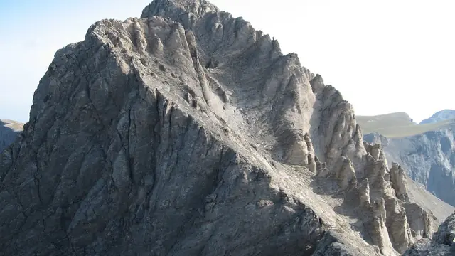 Mount Olympus (Mytikas)Class 3 scramble
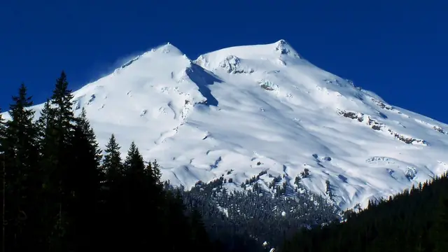 Mt BakerGlacier travel
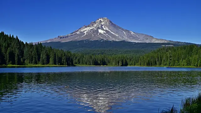 Mt HoodSnow climb with crevasse risk
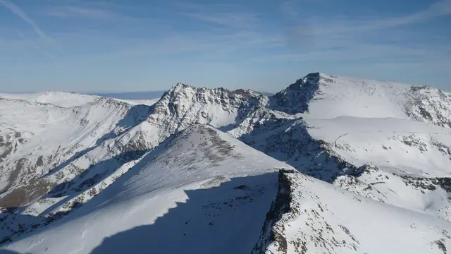 MulhacénNon-technical walk-up
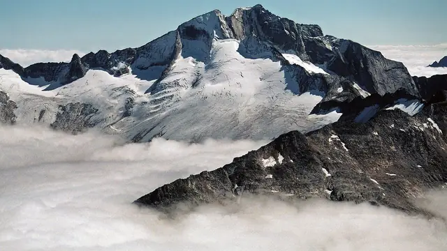 HochalmspitzePD Via ferrata and glacier
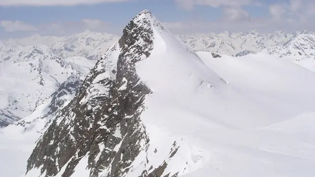 ZuckerhütlPD Glacier and rock ridge
Photos: Mount Olympus (Mytikas): Melkov (CC0), via Wikimedia Commons; Mt Baker: Lhb1239 (CC BY-SA 3.0), via Wikimedia Commons; Mt Hood: Kevin Crosby (CC BY-SA 2.0), via Wikimedia Commons; Mulhacén: Miguel Ángel Hontanilla Pozo (CC BY-SA 3.0 ES), via Wikimedia Commons; Hochalmspitze: Petr Drápalík (Public domain), via Wikimedia Commons; Zuckerhütl: Pizza (Wikimedia Commons user, CC BY-SA 3.0), via Wikimedia Commons.
Tools and deeper reading
Take this further
- Peak Progression Planner · See where Aneto sits in a full progression and the graded paths around it, from a fast line to a cautious foundation.
- Summit Check · Test whether you are ready for Aneto today. Free, science-backed, a few minutes.
- Training for Mountaineering · How TTM builds personalised mountaineering training plans backwards from your summit date, recalculated every week.
- Train for Triglav · The highest peak in the Julian Alps, steep via ferrata with serious exposure.
- Train for Toubkal · The highest peak in North Africa, non-technical in summer and alpine in winter.
- Altitude Acclimatisation Guide · The four acclimatisation training protocols and how to fit them into your build.
- Muscular Endurance for Mountaineering · The pillar guide on the quality that turns gym strength into legs that last a summit day. Pair with the free Muscular Endurance Calculator to score where you stand.
Training for Aneto: the takeaway
Preparing for Aneto takes more than general fitness. It is a specificity problem. Train for the mountain's actual demand profile: a sustained Z2 engine, real glacier-travel skill, calm movement on the Puente de Mahoma, descent eccentric capacity, and a rehearsed long day.